
Transportation Plan
Building a low-carbon future mobility city
through advanced transportation and eco-friendly infrastructure
A smart transportation city
connecting the sky,
ground, and underground
From UAM to shared personal mobility, a futuristic transport system enabling fast and convenient movement for everyone Creating a smart mobility hub integrating urban, metropolitan, underground, and surface networks.
Shared and public transportation-oriented system Introducing diverse eco-friendly modes of transport
-
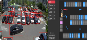
- Shared Mobility
- Introducing shared parking, personal mobility(PM), and shared vehicles
-
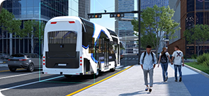
- Autonomous Shuttles
- Introducing autonomous buses within the Yongsan International Business District
-
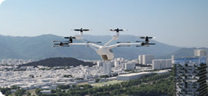
- UAM
- Connecting Incheon and Gimpo Airports to Yeouido, Yongsan Station, and Jamsil
Reorganizing the transportation network around public transportation and enhancing implementation capacity Achieving a 70% public transit modal share
-
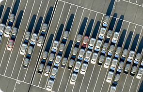
- Traffic Demand Management Plan
- Strengthening parking limit policies
Enhancing corporate commuting demand management(implementing the 5-day rotation driving restriction)
Parking fee increase
Road Plan

-
Strengthening East–West Connectivity Building new east–west and north–south roads to link with surrounding networks
-
Reducing Urban Congestion Combining grid and loop-type road systems to disperse traffic volume and enhance accessibility
-
Improving Direct Connectivity Connecting the front of Yongsan Station to Baekbeom-ro
| Classification | Metropolitan Transportation Improvement Plan(Draft) | Length (km) |
Lanes (two-way) | Remarks | ||
|---|---|---|---|---|---|---|
| Description | Plan | |||||
| A-1 | Seobinggo-ro | New east–west underground road connection | 2.4 | - | 2~8 | New construction |
| A-2 | Ichon-ro | New underground connection to Gangbyeonbuk-ro (toward Guri) | 1.5 | - | 2~4 | New construction |
| A-3 | Baekbeom-ro | Demolition and underground relocation of Samgakji Overpass | 0.7 | 2 | 4 | Operational Improvement |
| B-1 | Cheongpa-ro | Construction of a north-south underground roadway (Cheongpa-ro to project site) | 0.75 | - | 4 | New construction |
| B-2 | Frontal road | New road connecting the front of the Yongsan Station to Baekbeom-ro | 0.33 | - | 2~4 | New construction |
| C-1 | Intersection | Improvement of the North End Intersection and Traffic System of Wonhyo Bridge | - | - | - | Operational Improvement |
| C-2 | Intersection | Improvement of the West-Side Connecting Intersection | - | - | - | Operational Improvement |
| C-3 | Access Road | Improvement of the access system for Gangbyeonbuk-ro and Wonhyo-ro | - | - | - | Operational Improvement |
| D-1 | Underground Trunk Road | New construction of the South-North Underground Trunk Road | 6.0 | - | 4 | New construction |
| D-2 | Underground Trunk Road | New construction of the North-West Underground Trunk Road | 9.0 | - | 4 | New construction |
Railway and Public Transportation Plan
Direct connection with airport railroad + centered on the Metropolitan Transit Center
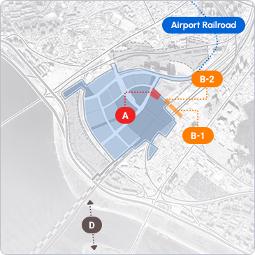
| Classification | Project title | Description |
|---|---|---|
| A | Establishment of a new metropolitan transit center | Developing a transfer system between multiple transportation modes |
| B | Improvement of the transfer system at Yongsan Station | Enhancing pedestrian accessibility and transfer convenience |
| B-1 | Construction of new underground pedestrian and transfer passages | Addition of underground walkways and vertical transfer passages connecting platforms |
| B-2 | Installation of additional GTX-B entrances | and vertical passages to accommodate new demand |
| - | Support for public transportation operations and initial costs | Providing initial subsidies to enhance convenience and encourage public transportation use |
| C | Direct operation of the Airport Railroad to Yongsan Station | Improving airport accessibility through direct train service connections |
| D | Construction of the Hangang Pedestrian Bridge(Art Bridge) | Establishing a pedestrian network connecting the project site with Noryangjin |
| - | Traffic Demand Management Plan | Formulating measures to promote public transportation |
Direct Connection of the Airport Railroad to Yongsan Station
- Operation
- Express trains to Yongsan Station(approx. 49 minutes, 1–2 trips per direction)
- Route
- Direct connection from/to the airport to/from the Yongsan Station using the Susaek Link Line and Gyeongui–Jungang Line

Enhancing time efficiency
and maximizing airport accessibility
as an international business hub!
Metropolitan Transit Center

Creating a user-centered, optimized multi-level transfer center
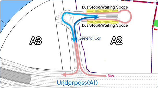
Establishing a metropolitan transfer system utilizing the underground level (B2)
Increased bus accessibility for Seoul and Gyeonggi,
reduced station congestion,
and shorter average transfer times!
Autonomous Driving Route
& Nodeulseom Pedestrian Bridge
A new pedestrian bridge across the Hangang River connecting Yongsan to Nodeulseom
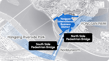
Proposed Route
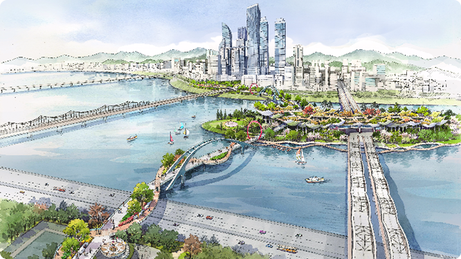
Example Layout
* The above renderings and images have been produced to help visitors understand the project and may differ from the actual development.